|
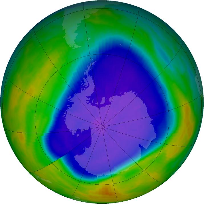
Ozone Hole 1992
http://ozonewatch.gsfc.nasa.gov
Anomalous Antarctic Ozone During 1992: Evidence for Pinatubo Volcanic Aerosol Effects
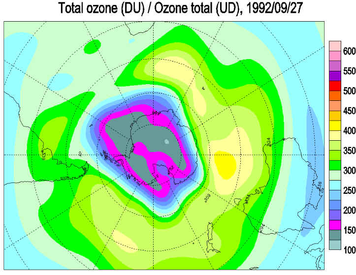
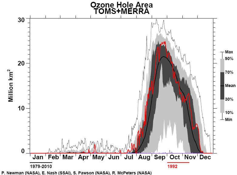
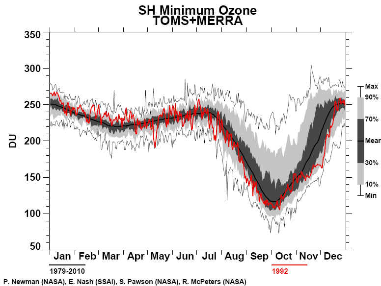
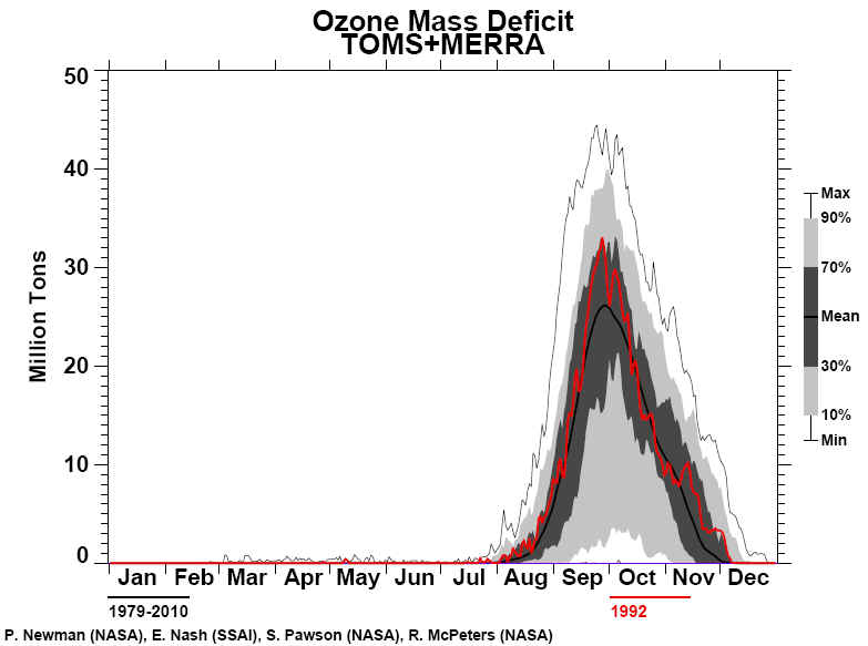
Unusual stratospheric ozone levels were observed in the Antarctic stratosphere
in 1992. The rate of ozone decrease during formation of the springtime ozone
hole and the severity of ozone loss in the lower stratosphere were greater in
1992 as compared to previous years. Total ozone reached an all time low of about
105 Dobson units on October 11 at South Pole Station. On this day, the
balloon-borne instrument encountered an apparent ozone void between altitudes of
14 and 18 km. Ozone profiles showed evidence of unusual ozone depletion in
autumn, before polar stratospheric cloud existence temperatures were reached.
Satellite measurements indicated that the 1992 ozone hole was about 25% larger
in geographical extent than in previous years. The possible effects of the
eruption of the Pinatubo volcano in the Philippine Islands in 1991 are
investigated, and it is concluded that the sulfuric acid droplets, which formed
in the stratosphere following the eruption and were trapped in the south polar
vortex, are the most likely source of the anomalous Antarctic ozone depletion in
1992.
|
||||||||||||||||||||||||