|
Environment Canada
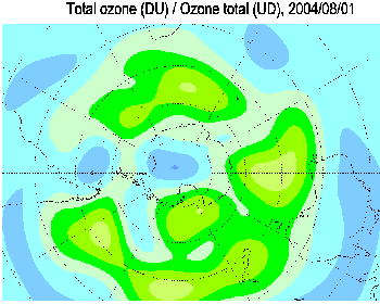
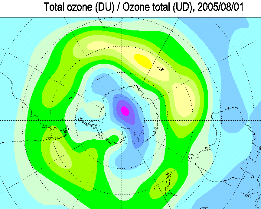
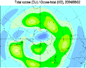
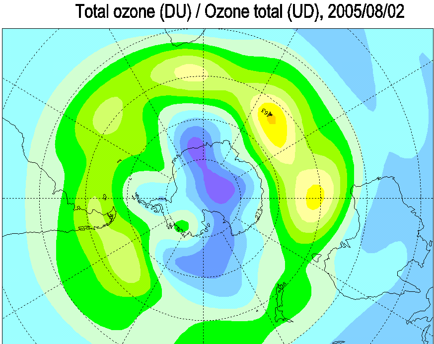
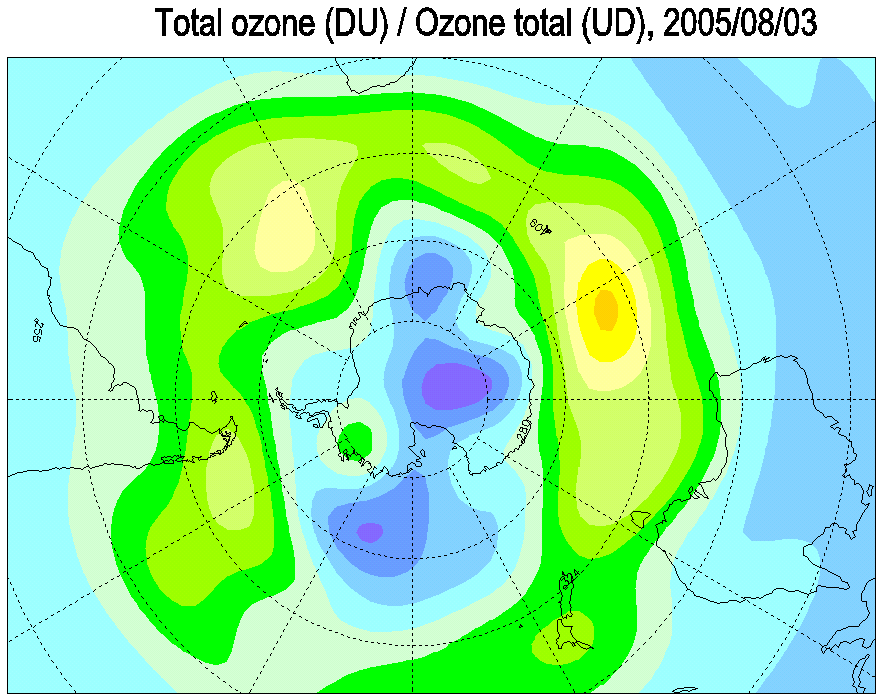
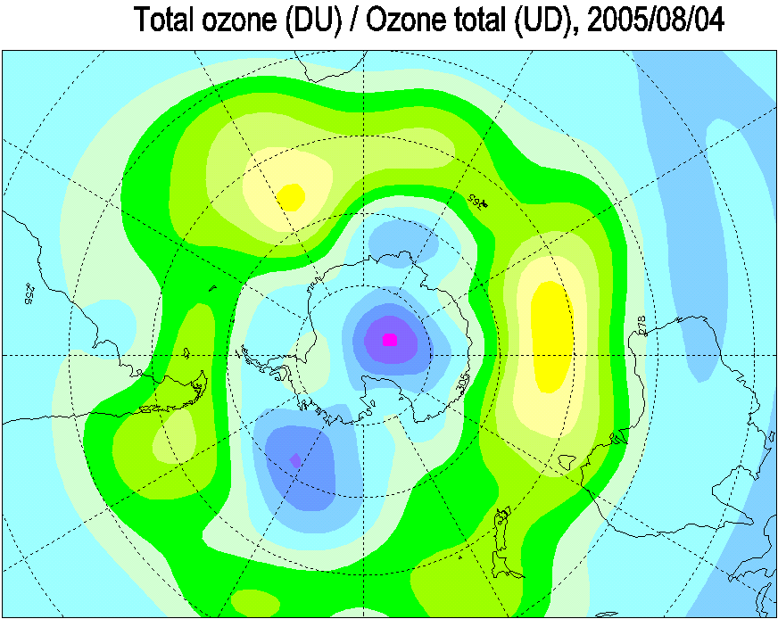
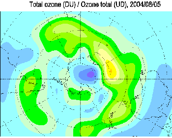
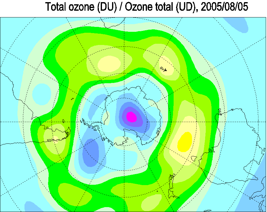
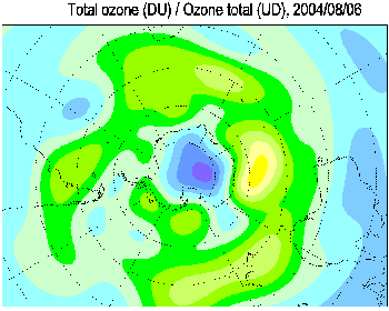
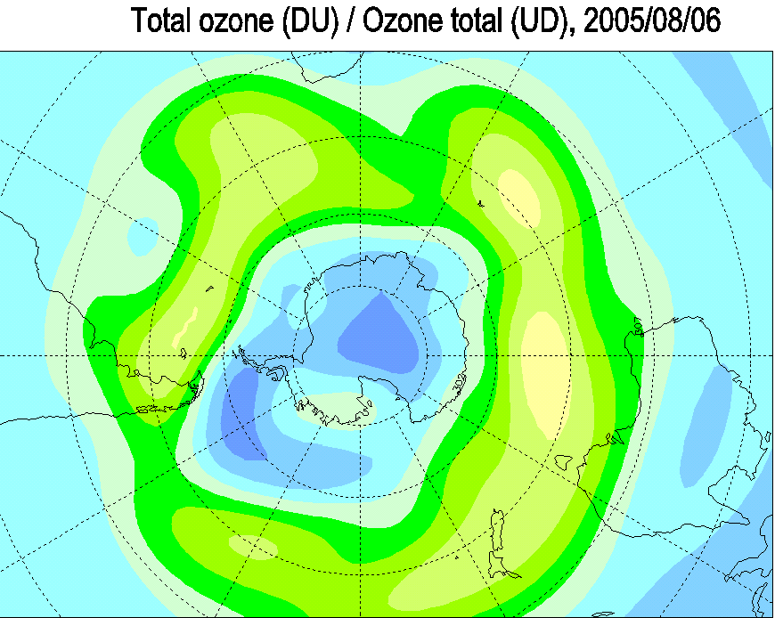
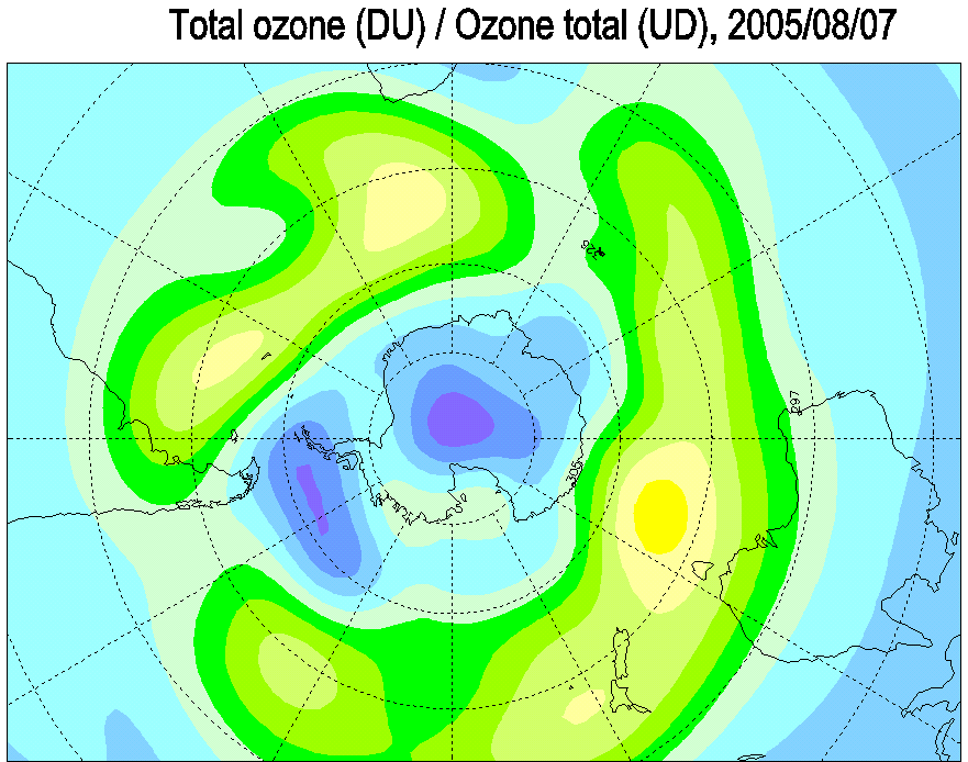
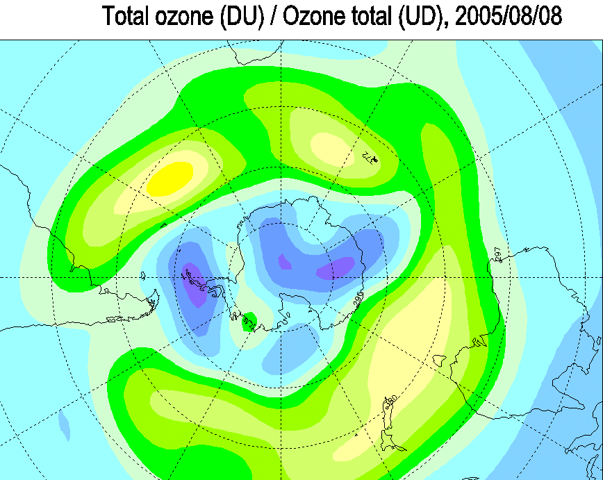
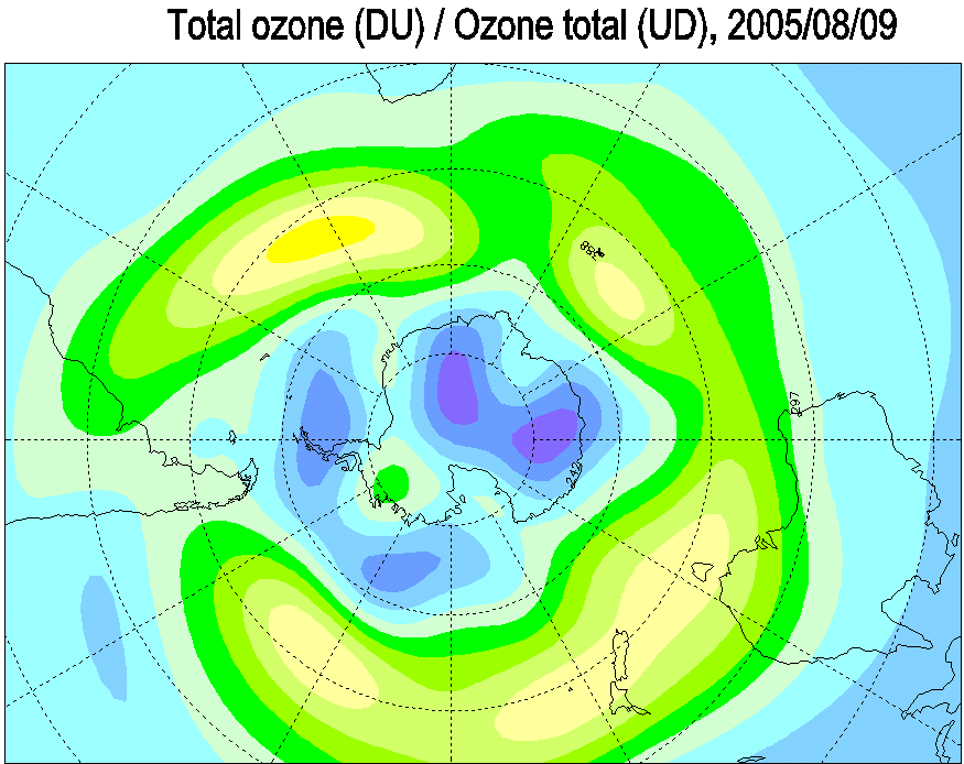
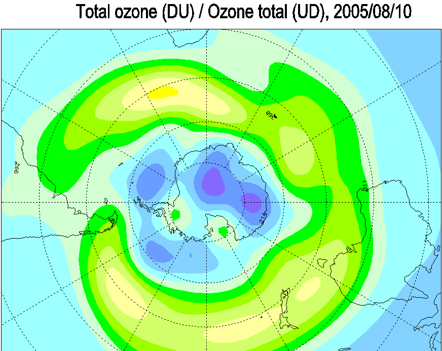
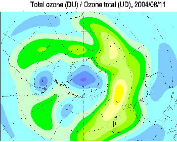
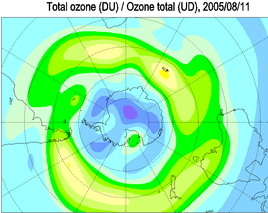
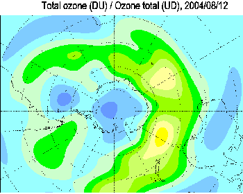
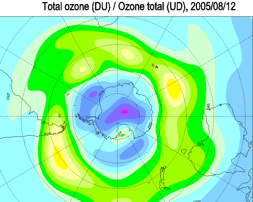
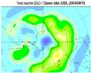
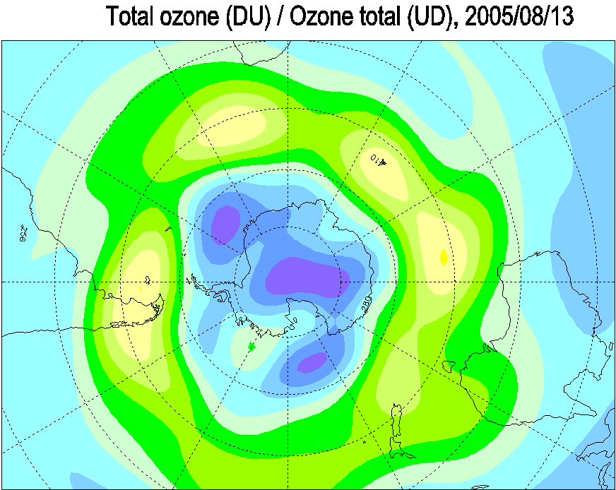
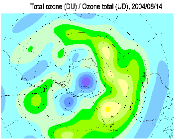
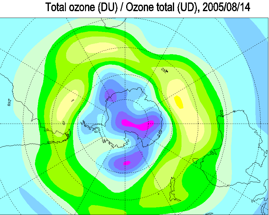
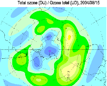
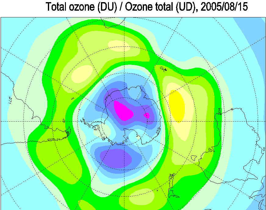
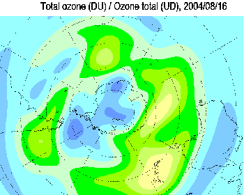
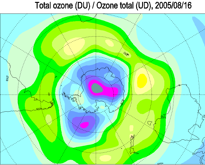
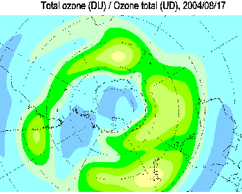
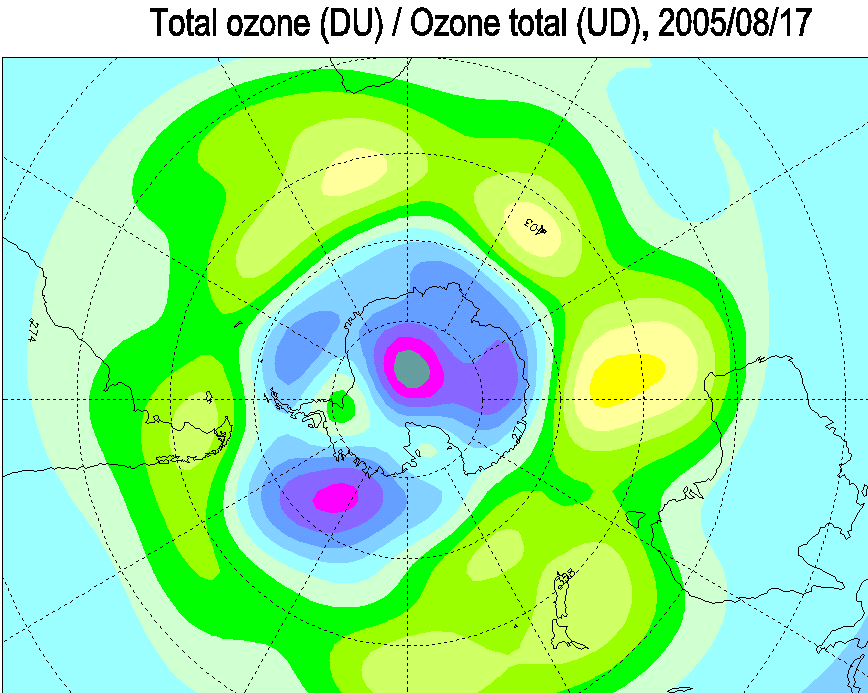
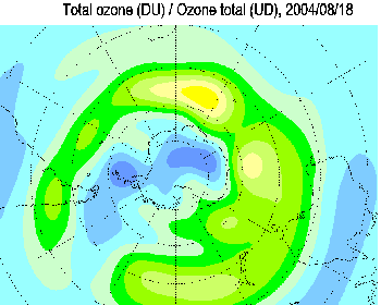
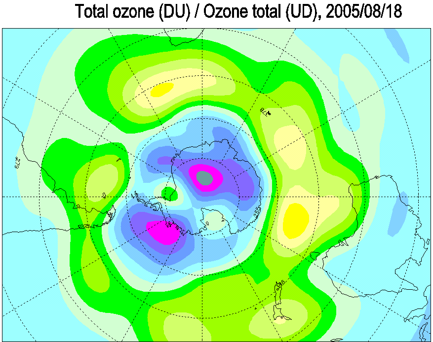
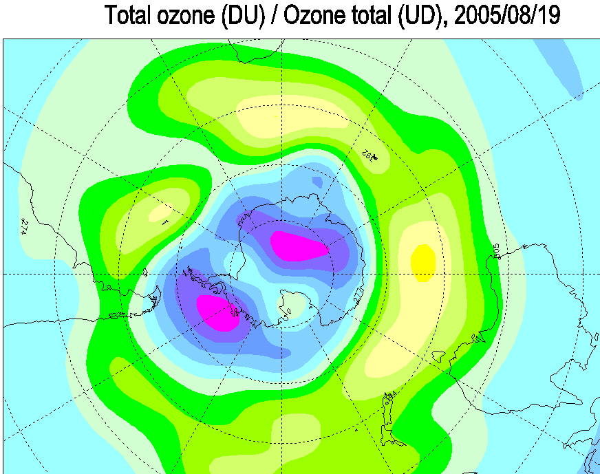
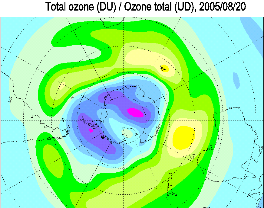
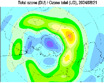
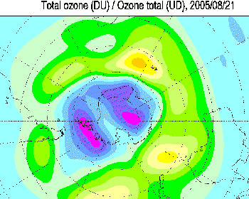
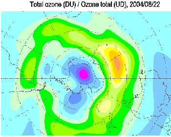
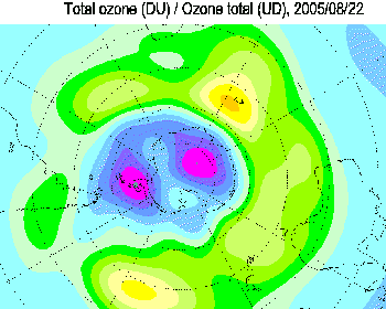
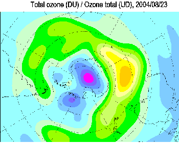
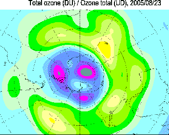
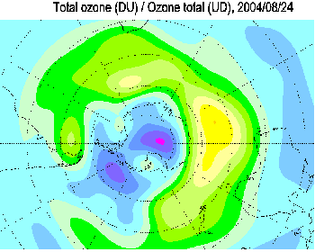
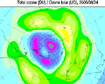
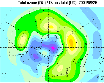
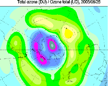
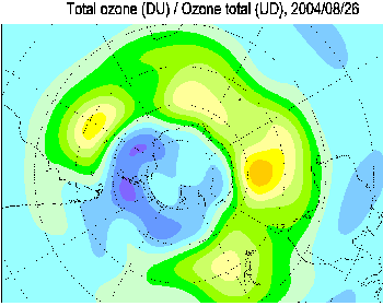
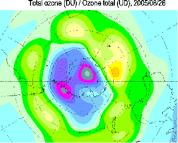
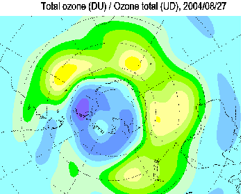
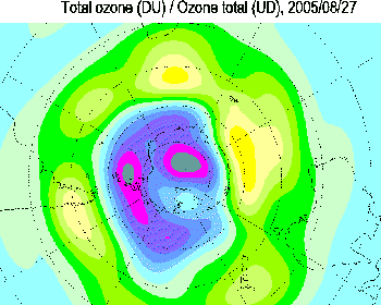
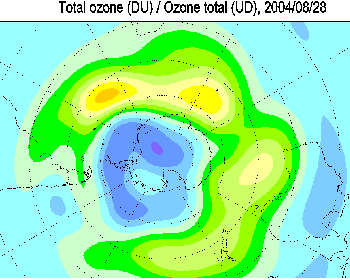
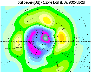
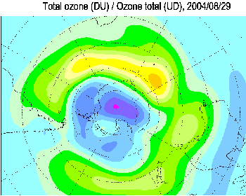
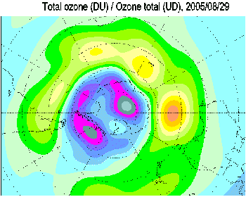
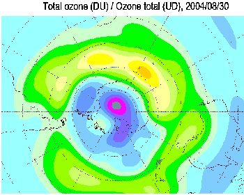
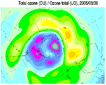
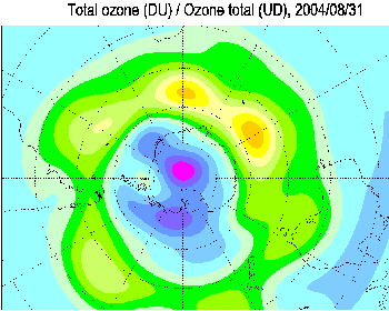
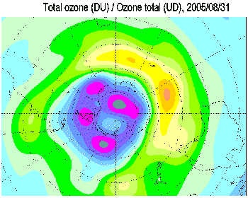
The total ozone maps are based on ground-based measurements
available from the World
Ozone and Ultraviolet Radiation Data Centre. Preliminary near real-time data
from ground-based observations were also used for the most recent maps. Total
ozone values are given in
Dobson Units. The numbers represent observations taken from ground stations
situated at the bottom left corner of the number.
Maps of deviations represent total ozone deviations from the
1978-1988 level estimated using Total
Ozone Mapping Spectrometer (TOMS) data for all areas except the Antarctic
and from the pre-1980 level estimated using Dobson data over the Antarctic.
Over areas with poor data coverage adjustments are made
according to TOMS on Nimbus-7,
Meteor-3, ADEOS and Earth Probe satellites. Over the polar night area Dobson and
Brewer moon observations and/or
NOAA's TIROS Operational Vertical Sounder (TOVS) satellite data are used.
TOVS data are also used when the more reliable TOMS data are not available. The
mapping algorithm is similar to those used by the
WMO Ozone Mapping Centre.
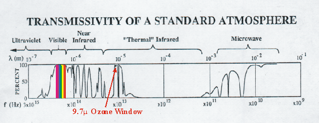
NOAA's TIROS Operational Vertical Sounder(TOVS)
NOAA's TIROS Operational Vertical Sounder(TOVS) is a suite of three
instruments: the Microwave Sounding Unit(MSU), the High resolution
Infrared Radiation Sounder(HIRS), and the Stratospheric Sounding
Unit(SSU). Each instrument measures radiation emmitted by the Earth at
several different wavelengths. The HIRS channel 9 measures Earth's
emmitted infrared radiation at
9.7 microns (10-6 meters). This is a "window channel"
meaning that the radiation measured by the HIRS instrument is emmited from
the earth's surface (as opposed to radiation being emmitted at other
levels of the earth's atmosphere). The amount of radiation reaching the
HIRS instrument is dependant upon how much ozone is in the earth's
atmosphere (less ozone = more radiation). Therefore, the TOVS Total Ozone
algorithm uses this channel (along with information from other HIRS
channels) to estimate the total amount of ozone in the earth's atmosphere.
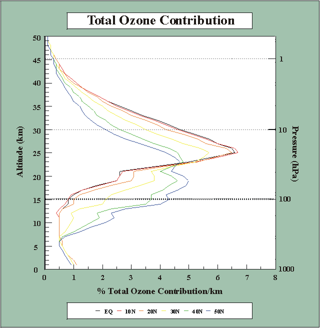
The greatest
contribution of the emmitted radiation occurs in a region between 200
hPa and 30 hPa (13km to 27km). This "lower stratosphere" region is below
the levels where the
greatest contribution to the total ozone amount occurs(50hpa to 10hPa
or 20km to 30km). Thus the ozone amount measured by the TOVS Total Ozone
algorithm is not a true measure of the "total" amount of ozone in the
earth's atmosphere. Rather it is a better measure of the ozone amount in
the lower stratosphere. To obtain a "total" ozone amount, the TOVS Total
Ozone algorithm adjusts the lower stratosphere ozone amount by a
climatological amount that is variable with season and latitude.
This is in contrast with satellite instruments which measure the amount of
backscattered radiation at various ultraviolet wavelengths. Backscattered
radiation levels at wavelengths where ozone absorbtion does and does not
take place are compared with the same wavelenghts measured directly from
the sun to derive a "total ozone" amount in the earth's atmosphere. This
methodology is used by the
NASA TOMS and the
NOAA SBUV/2 ozone monitoring programs. This methodology provides a
truer measure of the total ozone amount in the earth's atmosphere. One
drawback is that this method uses "backscattered" sunlight. Which means
that data cannot be retrieved in the earth's shadow or polar night
regions.
The TOVS Total Ozone algorithm can determine ozone amounts at all times
since it is derived from the Earth's emmitted infrared radiation. There
are drawbacks to the TOVS infrared methodolgy though. When the earth's
surface is either too cold (e.g., the high Antarctic Plateau) too hot
(e.g., the Sahara desert) or too obscured (e.g., by heavy tropical cirrus
clouds) the accuracy of this methodolgy declines.
|


